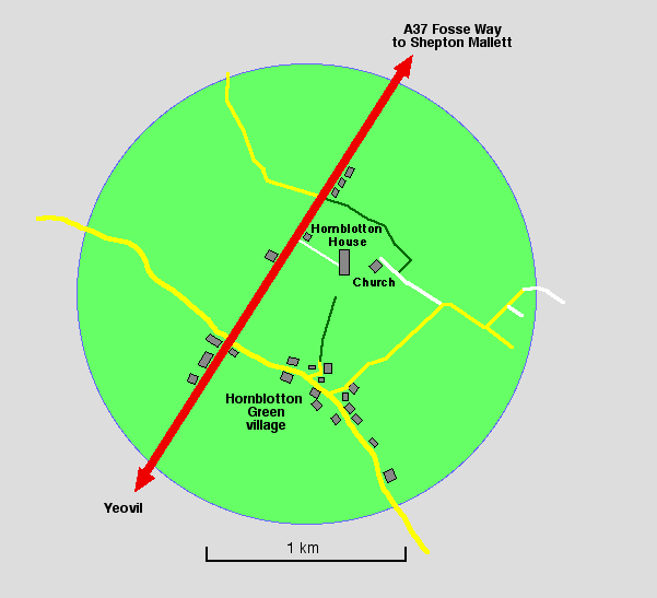
Hornblotton is a small village just off the A37 about 7 miles South of Shepton Mallet in Somerset. The majority of the buildings are at Hornblotton Green, consisting of farms and houses, strung along the lane between the A37 and the B3153 near the village of Alford. See map below. Hornblotton is at: 51° 06' 16.62" N 2° 55' 09.90" W. Postcode BA4 6SB
I lived there for over 2 years at the end of the 1990's. At first glance it looks unremarkable. However about half a mile to the north are Hornblotton House and St. Peter's Church, the latter being unique for its interior, former clock and organ.
It is the house and church which are actually known as Hornblotton. The name Hornblotton is the modern version of its ancient name of Hornblawetone, which means "The horn blower's settlement". It is even mentioned in the Domesday book: "Of the land of this manor Serlo de Burceio holds five and a half hides in Horblawetone". [sic] One idea as to the origin of the name is that horns were blown at this location to let people know that the surrounding levels (prone to flooding) were safe to cross. Another is that the Saxon lord may have been given it in return for leading the King's hunt. According to "The Histories and Antiquities of Somerset" by John Collison in 1791: "It's ancient name was Hornblawerton, and it was given by King Ethelbald to Earl Enulf, one of the attendants of his court, who, with the consent of King Ethelwolf, bestowed the same on the great monastery of Glastonbury." Ethelbald was king of the West Saxons between 855-860.
The house and church are Victorian but these replace earlier structures at the same location. The house is the former rectory and has been extended several times in the late 19th and early 20th centuries.
The fact that the church is so far from the village raises speculation as to why. It may be a former plague village, for example, with the new village eventually being built at Hornblotton Green. If so, where was the orginal village? Was it after all just a flood monitoring site, so no actual village ever existed there? Also there are two "green lanes" approaching from both north and south, both ending at opposite ends of the field to the immediate south of the house and church. Whether they were originally joined through that field is also conjecture. There is a depression across the field between the two which might suggest this, which is also a former field boundary long since removed to make one field.
In the corner of same the field, by the church, is a raised rectangular area which may be the site of a previous rectory. The current former rectory was built on a brand new site, so any previous rectory was elsewhere. There are references to the rectory at Hornblotton in the Somerset & Dorset Notes and Queries, Vol. X, 1907. This refers to one Alice Moone once owning the parsonage of Hornblotton and that it was inherited by a Hugh Gwyn, witnessed in "...the sevynth day of the monethe of Decembre in the xviii yere of the reigne of King Henry the eight."[sic]. Which would be 1527.
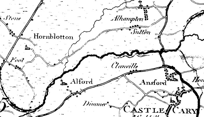
Maps which pre-date the construction of Hornblotton House show the northern green lane as part of a through route across the fields south of Ditcheat and north of Castle Cary. A route which no longer exists. However no structure other than the church is shown at Hornblotton.
Hornblotton is at: 51° 06' 16.62" N 2° 55' 09.90" W. Postcode BA4 6SB